About Me

My photo
Toronto, Ontario, Canada
"To take a photograph is to align the head, the eye and the heart. It's a way of life." ~ Henri Cartier-Bresson
Showing posts with label aerial photography. Show all posts

Tuesday, September 24, 2013

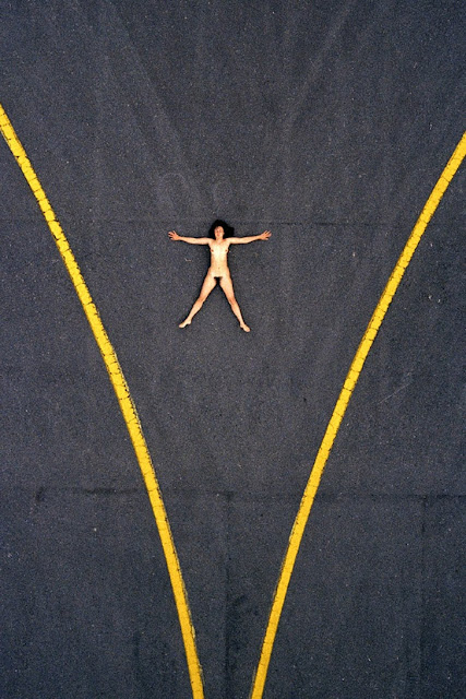
Unabashed Aerial Nudes by John Crawford

John Crawford is a New Zealand based photographer who did a lot of commercial work back in the 80's. He spent much of his time in helicopters and light airplanes, and became fascinated with looking at the world from a bird's eye perspective. In 1984, between shoots, he had an idea for a personal project called Aerial Nudes, the results of which you see here.

The project lasted for three years, from 1984 to 1987, when Crawford dedicated his spare time to meticulously planning and executing each shot, dreaming up ever more surreal scenarios. "Part of the thrill was coming up with the ideas, which in some cases were seemingly impossible, and making it work," he says. "I'd hire a small fixed-wing aircraft for an hour and hunt for abstract details in the landscape where I could strategically place a nude. I would shoot reference images of each location, which I would print. On these, with a black ink pen I would sketch little stick figures and add the various props I would need." [via IndependentUK]




Wednesday, April 17, 2013

SkyMotion's Helicopter Drone Video of Niagara Falls ~ Stunning!

The SkyMotion Video team provided the aerial video services for the shoot - making use of their state of the art remote controlled helicopter drone. Niagara Falls has of course been filmed countless times in the past using full sized helicopters. However, with this remote controlled helicopter, the shoot was not limited by minimum altitude restrictions, and so was able to achieve shots which were unlike any before. Flying only a couple feet above the water, the camera was able to approach the waterfall edge to give the viewer a true sense of the shear scale of the world famous falls.


watch full screen HD!

Friday, November 16, 2012

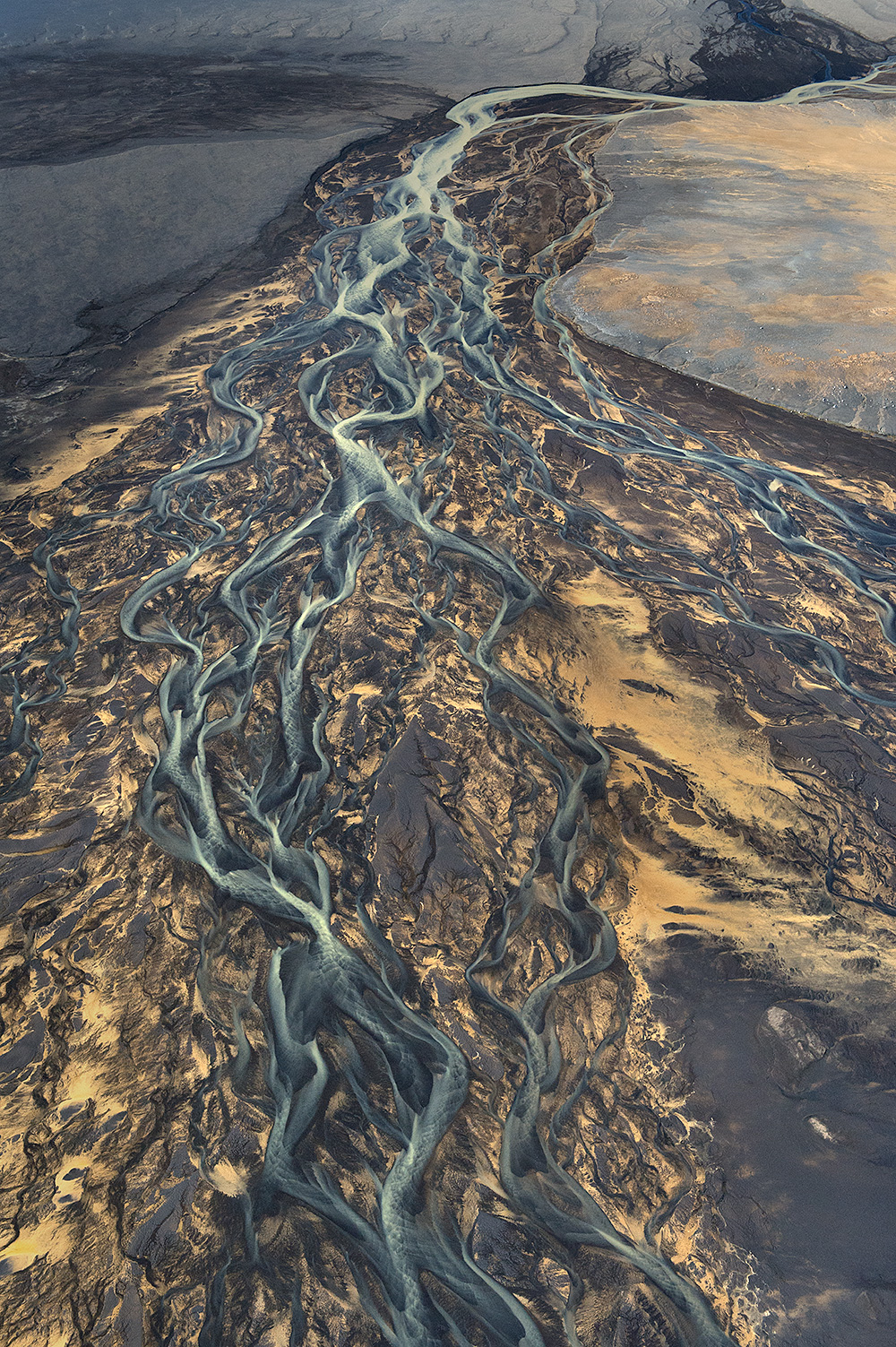
Stunning Aerial Photographs of Icelandic Rivers by Andre Ermolaev

"Iceland is a wonderful country; I would even say that it is a true paradise for all the photo shooting-lovers. But what has become a real discovery for me is the bird’s eye view of the rivers flowing along the black volcanic sand. It is an inexpressible combination of colors, lines, and patterns. The photo represents the mouth of the river falling into the ocean. "A little bit upstream there is a yellow-colored brook flowing into the river, but yellow currents fail to mix with the main water flow. One can estimate the scale judging by the car tracks that are clearly seen on the black sand. This is just a river, just a volcano, just our planet." ~ Andre Ermolaev

**click on images for a larger view**


Thursday, September 27, 2012

Pilot Your Very Own Drone Equipped With A HD Camera ~ The AR.Drone 2.0

The AR.Drone 2.0 is at the crossroads where high-tech meets Icarus dream. Fly like a bird. View the earth from high above in high definition. Share your experience online with your friends. Control the AR.Drone with your smartphone app for iPhone, iPad and Android devices and upload your epic birds eye view videos. [via A.R Drone]

 Check them out on Facebook: www.facebook.com/parrot


A flying HD camera
While in flight, the Parrot AR.Drone 2.0′s front camera transmits real-time what the quadricopter sees onto the pilot’s device screen.
For the first time the AR.Drone 2.0 camera, with a 1280×720 resolution, shows a view from the sky in high definition with smooth and unbelievable images.
The pilot enjoys an experience like never before, as if he was on board. For gaming purposes, this camera also can recognize specific shapes and colors to show augmented-reality elements on the smartphone’s screen.
Record and share flying experiences
Thanks to the new AR.FreeFlight 2.0 piloting application, players can record their own HD videos and watch them or share them with the AR.Drone community.
Additionally, with the “travelling” feature, the pilot can film HD video sequences like a professional! Simply select the direction of travel (forward, back, sideways) and the duration, and the AR.Drone 2.0 does the rest.

AR.FreeFlight 2.0, a new piloting and sharing platform
In addition to flying the AR.Drone, new application AR.FreeFlight 2.0 – available to download for free from the AppStoreSM and AndroidTM Market – offers players a new interface and several options.


Thursday, September 13, 2012

Google Earth Fractals Photographs

A fractal is a rough or fragmented geometric shape that can be subdivided in parts, each of which is (at least approximately) a smaller copy of the whole. Fractals are generally self-similar (bits look like the whole) and independent of scale (they look similar, no matter how close you zoom in). Many mathematical structures are fractals; e.g. {Sierpinski triangle}, {Koch snowflake}, {Peano curve}, {Mandelbrot set} and {Lorenz attractor}. Fractals also describe many real-world objects that do not have simple geometric shapes, such as clouds, mountains, turbulence, and coastlines. {Benoit Mandelbrot}, the discoverer of the {Mandelbrot set}, coined the term "fractal" in 1975 from the Latin fractus or "to break".

[images via Google Earth Fractals]


Ron Eglash: The fractals at the heart of African designs